Note to reader: The below updates were originally posted to a group chat that I was using to keep my family and friends updated on the progress of my sea adventure.
Update 7-November
This morning I am reflecting on those who made this perilous journey across the Atlantic all those years ago. Trying not to cry.
😔
https://goo.gl/maps/pxmMbJiV3zaNQ4t4A
Update 8-November
Today is day 8 of my 3-week planned sea passage from the Canary Islands to St. Thomas, US Virgin Islands. So that is one week done !
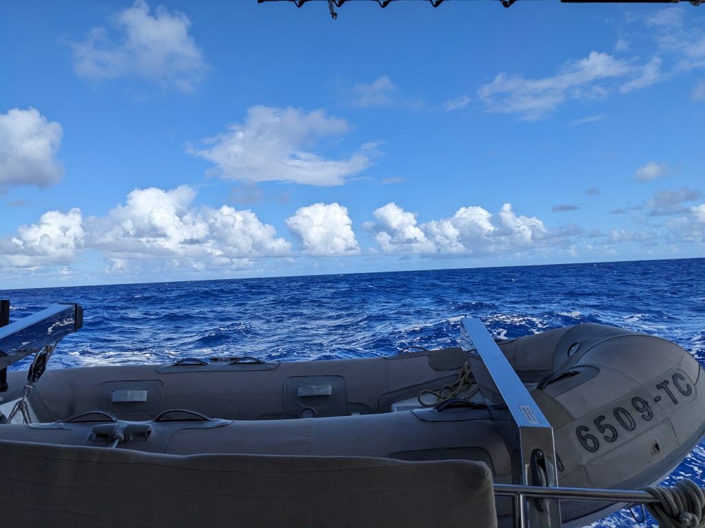
We are currently travelling in a westerly direction, headed as straight towards our destination as the wind and weather conditions allow. At this point we are 710 nautical miles from the west coast of Africa, 500 nautical miles northwest of Cape Verde, and about 1,940 nautical miles from our destination. So we are truly in the middle of the ocean 🤣
Yesterday started out very somber for me, as I could not help to think about my ancestors making a similar passage, but under drastically different circumstances 😥 . But it is also uplifting in a way, to see that I am here reclaiming the past and making my own story now. And although we don’t see a lot of Black representation in the recreational sailing world, I am still standing on the shoulders of other great men who have already successfully made this or other longer crossings:
Bill Pinckney: circumnavigated the globe
https://www.nytimes.com/2023/09/01/sports/sailing/bill-pinkney-dead.html
Teddy Seymour: circumnavigated the globe
https://nshof.org/nominees/seymour-teddy
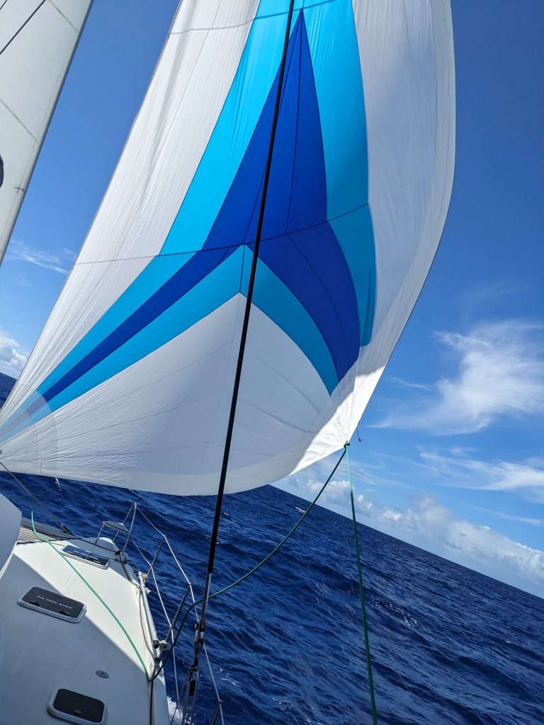
Now back to the sailing: in the last 2 days, conditions have been up and down. On Monday, the weather that we thought we had avoided caught up with us, so much so that we had to shorten up our sails (called “reefing” the sails) to prevent the high winds from overpowering the boat and enable us to continue sailing on wind power through the storms.
When these squalls pass through, the sailing gets exciting! The wind is literally whipping around you and the sailboat is sometimes cutting through waves, sometimes swaying wildly, and other times surfing down large swells that get your speed up to 11 knots ! And all this is happening both day and during night watch!
The wind finally died on us earlier this morning though, so we had to run on motor power for 3-5 hours, until the wind picked back up and we were able to let our sails back out.
There is currently another squall that caught up with us, so we are sailing again in the light rain. Hopefully once we are through with this weather, we will be able to get back to our steady tradewinds-powered passage.
Here is our current location:
https://goo.gl/maps/mbCdPFZ2NTqy2mCo9
Update 8-November
It is now day 9 of my planned 3-week sea passage from the Canary Islands to St. Thomas, USVI. At this point we have travelled a bit more than 1/3 of the way to St. Thomas, which matches up with the planned 3-week trip duration since 1 week has already passed. We are travelling west and slightly south, in a direct path to our destination.
As I said in yesterday’s update, some storms caught up with us late morning. Of course on a long passage such as this, you (I) would always prefer nice warm weather, clear skies, and steady winds. If there is any upside to rainy weather systems when you are under way in a sailboat though, it’s that the winds tend to be strong — so if you are a confident and competent sailor, you can make some great time by keeping your sails out and sailing through the storm.
There are exceptions to this: for example it’s best to avoid lightning storms (the mast can be very attractive), and if the seas or winds get too exciting then you might go from an invigorating sail to hunkering down, dropping sails and riding out the storm inside.
In our case, the winds were dying and we had slowed a lot just before the squalls rolled in. So aside from higher waves and swells, we were helped along by the wet weather.
Dinner was tricky though. Because of the wild rocking of the boat, we had to scratch our original chicken curry plan and just throw some tortilla chips in a pan, empty a bag of shredded cheese over the top and spoon over some canned chili to make a quick casserole of nachos. The nachos turned out fine, and was a good meal/snack given the circumstances.
By the time night watch started, we still had big waves but the major part of the storm had passed and we could see it moving ahead of us. We did make a changeover of sail plan again at night, but by now that is becoming somewhat routine so it’s not a big deal 😎
Now it is Thursday morning, we’re still sailing on wind power at about 6 knots (6 nautical miles per hour) and the sun is trying its best to peek through the clouds in the sky. Maybe we’ll have some pancakes today? 🥞🍳🥓😋
Here is my current location:
https://goo.gl/maps/5ubX4knsec57i7s26
Update 10-November
It is now day 10 of my planned 3-week sea passage from the Canary Islands to the Caribbean. The original plan was to sail to St. Thomas, USVI, but plans have changed — now we are targeting the British Virgin Islands as our destination. The captain has some business to attend to there, so it makes sense to stop there. Plus it is a bit closer, so there you go.
There are still 1,661 nautical miles left to go on our voyage. The winds have slowed down now, so we have raised our third sail again to try and get as much speed as possible with the wind.
Yesterday we caught another fish, this time a wahoo. It was not as big as the mahi mahi we caught last week, but still big enough to feed the entire crew for a heavy lunch.
It was also crew member Ezra’s birthday, so the first mate whipped up a batch of chocolate chip cookies, stuck a candle through a stack of ’em, and we celebrated his birthday with song and laughs.
The sun is out today, and clouds are starting to thin out. I can tell we are getting to tropical weather because I’ve switched to shorts– even at 7:30 in the morning it is pretty warm out 🌞
The seas have also calmed down, so it’s looking to be a much more relaxing sail today. It’ll be nice to just chill and catch up on my celestial navigation studies.
Here is our current location:
https://goo.gl/maps/NFFTxLYsXwzwtCr59
Update 11-November
Today is day 11 of my planned 3-week sea passage from the Canary Islands to the British Virgin Islands in the Caribbean. If you take our current location and look directly south, you will see that we are aligned with the eastern-most part of Brazil. That puts us in Sao Paolo time zone, or 2 hours ahead of New York time.
Which brings up the question of time: how do you manage time on a boat that is travelling from east to west, crossing time zones as it makes progress? And how do you know when you’ve crossed into a new time zone? Your phone can’t tell you the local time because you have no signal in the middle of the ocean. And does it really matter what time you say it is, until you get closer to your destination?
Well you have two basic options typically. Option one is to never change the clocks and watches on board until you are almost at your destination. Option two is to try to keep up with the time zones changing as you cross through them.
Option one, where you keep your clocks constant, is simpler. But then as you get further and further, the sunrise and sunset times will start to get strange. E.g. sunrise happened today around 6am. But if we hadn’t changed clocks since we left Gran Canaria, we would be seeing that the sunrise is happening at 4am then sunset at 4pm. And later we’d see a 3am or even 2am sunrise.
Option two where you keep up with time zone shifts may make more sense, but then you need to figure out when you’ve changed time zones, keep changing your clocks, and then figure out what the new times are for your day shift and night watches. On this boat we are using option 2.
When out at sea far from land, there is a nautical convention to determine time zones, related to your longitude. For every 15 degrees of longitude that you move west, the time moves back by one hour. So you can write out a table that tells you what the local time is compared to Greenwich, England time, based on ranges of longitude. Then when your logbook entry shoes that you’ve crossed into then next range of longitude, you know it’s time to change clocks again. These nautical time zones don’t always match up exactly with conventional country-based time zones, since most places prefer to not have one city span more than one time zone, for example. But the two time zone systems are close.
So there you have it– I know you were dying to know all of that detail 🤓
Yesterday was an amazing day of sailing! The sun was out, but it was not too hot thanks to the strong breeze. Waves were moderate in size, and coming directly from behind us so they gently nudged us along our course. And we were able to sustain a great pace of 5-7 knots (nautical miles per hour) on average.
Some crew members broke out cards for a game of cribbage, but I was on day shift so I kept with my celestial navigation studies while listening to the sounds of the boat cutting through the waves.
For dinner, I made a new recipe handed to me, called “Down Island Chicken Curry”. It uses an ingredient called “green sauce”, which is apparently very common in stores in the Caribbean…I guess you’re familiar with it, @Yohann ? Well anyway it is a quick & simple recipe, so dinner was on without too much trouble. (Sorry no pics of the meal, the plates emptied out too quickly 😀)
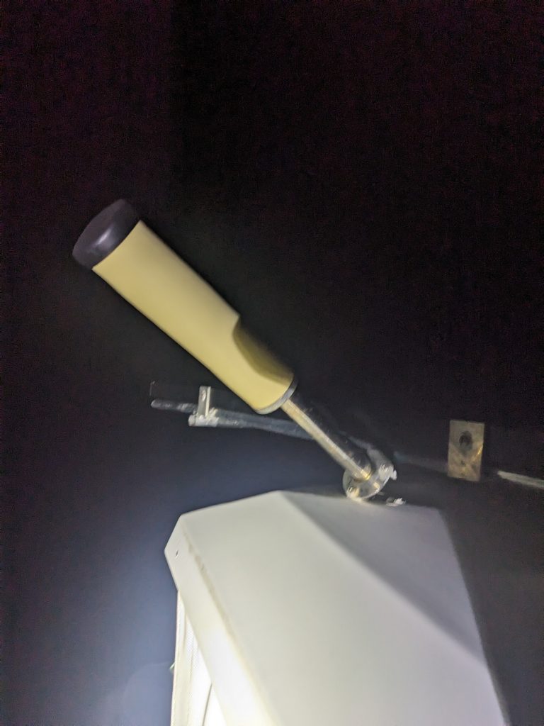
When my night shift started, I noticed that one of our rigging lines (ropes) had caught around the internet/cell phone network antenna, and had nearly ripped it off completely! 😱 Fortunately I noticed it before the mounting screws had all fallen overboard. So I woke up the captain and we managed to screw the antenna back into place. That was a close call! 🙏🏾We had good winds through the rest of the night after that.
I woke up this morning to another beautiful sunny day, with winds moving well and an update that we have changed clocks again. Looking forward to another great day of sailing!
Here is our current location:
https://goo.gl/maps/Yznyichi6qLPGA2A7
Update 12-November
It is now day 12 of my planned 3-week ocean passage from the Canary Islands to the British Virgin Islands. At this point we are about 1,450 nautical miles west of the Canaries, and only 1,375 miles away from our destination. So I guess that means we’ve crossed the halfway point ? 🥳
Yesterday was another great day of sailing! The closer we get, the more and more tropical it is starting to feel. So my long pants only come out for night watch these days, and my calves and arms are out for most of the day 😀
There’s plenty of time now in the day for me to make good progress on my celestial navigation course, so I’ve been spending a lot of time doing that 🤓
There is an “exercise challenge” we’re doing on board, to keep us motivated to stay healthy and fit. I am tied for last place 😥 due to my initial laziness…but I’ve decided to step it up so that if somebody else starts slacking off, I may have a chance. Loser buys drinks for the night once we land!
I normally like to do about 1 hour per day if walking as part of my fitness regimen. But in the boat that is not practical, so you gotta find some other way to get your heart rate up and stay fit. Enter our daily challenge: 50 push-ups (no knee push-ups for the fellas), 100 squats, 100 calf raises, 100 crunches, and either 2 minutes of planks or 100 hip thrusters/hip bridges.
Not my usual routine, but options are limited on the boat so I’m doing it 💪🏽
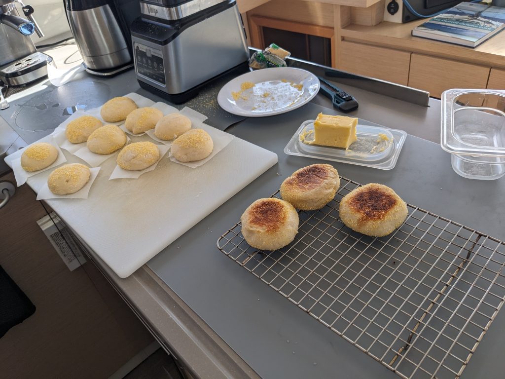
Nothing much more to report…captain made a beautiful set of English muffins from scratch, and night watch was routine except for a 10-minute downpour that got my hoodie wet.
It’s yet another beautiful day out today, and we are flying our third sail again hoping to keep our speed up. 🤞🏾
Here is our current location:
https://goo.gl/maps/tHuXpQZSzwCTPb5V6
Update 13-November
Today is day 13 of my planned 3-week ocean passage from the Canary Islands to the British Virgin Islands. We are heading west in a straight path to Tortola, with about 1,250 nautical miles remaining to go.
Yesterday was an easy day, with great sunny skies. We hoisted our third sail again to catch more wind and didn’t take it down until sunset.
As we near the 2-week mark, I realized that the days are starting to run together in my mind…was that yesterday that we played backgammon? Or the day before? Did we cut on the engine yesterday? Can’t remember….I guess that is what log books are for 😀
During my night watch, I decided to start learning to identify different stars in the sky. I started with Orion which I know how to spot, then worked my way around to some of the brighter stars: Sirius to the left, Aldebaran of the Taurus constellation in the other direction and Jupiter below that. Not bad for a first night of stargazing…looking forward to learning more.
It is now late morning and pretty warm out. Winds have died down so we are now motoring, hopefully we will be able to get back to sailing before too long.
Here is my current location:
https://goo.gl/maps/nL4fT8D1BggvPADL9
Next Post in series: 2023 Atlantic Crossing Week 3 >>
Previous Post in series: << 2023 Atlantic Crossing Week 1
( Part of series: Europe to the Caribbean with Abundance, My First Atlantic Crossing )